
Overview
MapGO is a web-based geospatial workspace that brings professional GIS capabilities directly into the browser. Created by developer Sebastian Janas, the platform eliminates the need for desktop software installations and complex setup. Instead, users can measure distances, analyze administrative hierarchies, convert coordinate formats, and process bulk location data through an intuitive interactive map. The service covers more than 250 countries and territories, leveraging high-resolution coastline and boundary shapefiles that MapGO maintains internally. This data fuels tools that determine distances to borders and coasts, provide location hierarchies, and support point-to-point calculations.
MapGO positions itself as a lightweight yet powerful alternative to traditional geographic information systems. It serves a diverse clientele, including logistics professionals, real estate analysts, data scientists, and software developers who need quick geospatial insights. The platform offers a generous free tier for casual users and a subscription model for higher-volume needs. While MapGO's headquarters and team size are not explicitly listed on the homepage, the product's active development is visible through its changelog and blog. The platform's global accessibility and browser-based design make it a convenient choice for distributed teams and independent professionals seeking GIS tools without friction.
Services & Expertise
MapGO delivers a suite of geospatial services through its workspace and API. Key offerings include:
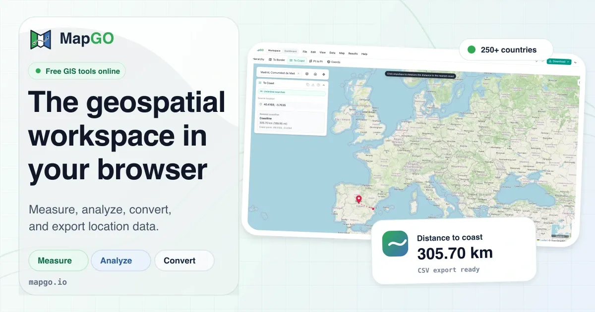
Distance to Coastline: This tool calculates the shortest distance from any given coordinate to the nearest coastline. It relies on high-resolution coastline shapefiles to provide accurate measurements, which is particularly valuable for coastal property assessments, marine logistics, and environmental planning. The result is returned instantly and displayed on the map.
Distance to Border: Users can determine how far a point is from the nearest country or regional boundary. This feature is essential for cross-border logistics, regulatory compliance, and geopolitical analysis. MapGO's boundary datasets include not only countries but also sub-regions, offering granularity that many online tools lack.
Location Hierarchy: Given a set of coordinates, the platform returns the full administrative hierarchy, from continent down to district. This includes country, region, and sub-region levels. It is useful for market research, address verification, and data enrichment, allowing users to understand the geopolitical context of any point on Earth.
Point-to-Point Distance: This utility computes the great-circle distance between two geographic coordinates, often called the "as the crow flies" distance. It is critical for route planning, flight path calculations, and comparing urban vs. rural distances. The tool supports multiple coordinate formats and provides results in both kilometers and miles.
GPS Coordinate Converter: MapGO simplifies the conversion of coordinates between Decimal Degrees (DD), Degrees Minutes Seconds (DMS), and Degrees Decimal Minutes (DMM). This feature is indispensable for surveyors, geocachers, and GIS professionals who work with different location formats across various systems.
Measure & Draw Tools: The workspace includes interactive tools for measuring distance, area, radius, and bearing directly on the map. Users can draw rectangles, circles, and polygons to create buffer zones and annotations. This functionality is beneficial for urban planning, site selection, and visual presentations, all while updating live as the user interacts.
File Conversion & Bulk CSV Processing: MapGO supports conversion between major GIS file formats: GeoJSON, KML, GPX, Shapefile, and CSV. Additionally, the bulk CSV upload feature allows thousands of latitude/longitude rows to be processed in one batch, ideal for cleaning datasets, geocoding, or preparing data for further analysis. The converted files can be downloaded immediately or loaded straight onto the map for visualization.
How They Work
MapGO's user journey begins with opening the interactive workspace. Users choose a tool from the sidebar, then either click directly on the map or input coordinates manually. For instance, the "Distance to Coastline" tool lets users drop a marker on any location and immediately see the distance to the nearest shore, along with a visual line on the map. All calculations occur in real time, and results can be copied or downloaded.
For file processing, the workflow is equally straightforward. The Convert section allows users to upload a file, choose the output format, and download the result. Bulk CSV upload requires a CSV with latitude and longitude columns, and MapGO validates and processes each row, providing a detailed summary of successes and errors.
New users can explore the suite without an account, with a limit of five lookups per day. Creating a free account increases this to ten per day and unlocks additional features. The platform's interface is designed to be self-explanatory, supported by documentation and blog posts that explain common use cases.
Developers can integrate MapGO's geospatial intelligence into their own applications via the REST API hosted on RapidAPI. The API exposes endpoints for full location data, including hierarchy, border distance, and coastline distance. A simple example in JavaScript shows how to fetch data for any coordinate with just a few lines of code, making the service accessible for prototyping and production use.
Ideal Client Profile
MapGO's tools serve a wide range of scenarios. Below are typical client profiles that benefit the most:
-
Logistics and Supply Chain Managers: A logistics manager at a freight company needs to know how close delivery points are to country borders to calculate customs delays. Using MapGO's Distance to Border feature, they can quickly assess routes and choose the most efficient paths, saving time and reducing unexpected costs.
-
Real Estate and Property Analysts: For a real estate analyst evaluating coastal properties, knowing the exact distance to the coastline is crucial for pricing and risk assessment. The Distance to Coastline tool provides this data instantly, allowing for more informed investment decisions and comparative market analysis.
-
Data Scientists and GIS Specialists: A data scientist working with geographic data often has to clean and standardize locations. The bulk CSV upload feature lets them process thousands of coordinates in one go, while the coordinate converter ensures all data is in the desired format for machine learning models or visualization tools.
-
Independent Developers and Startups: A mobile app developer creating a location-based service can use the RapidAPI to retrieve administrative hierarchy and border distances without building custom geocoding infrastructure. This reduces development time and costs, especially for early-stage products with limited resources.
-
Consultants and Researchers: A consultant studying geopolitical risk needs to determine the distance between key locations and national boundaries. MapGO's point-to-point and border distance tools offer precise measurements that support research reports and strategic recommendations.
These profiles highlight MapGO's versatility, from quick one-off calculations to large-scale data processing. The platform's free tier makes it easy to evaluate its capabilities before committing to a subscription.
Pricing & Engagement Models
MapGO operates on a freemium model with daily lookup limits. New users can perform five lookups per day without an account, while a free account increases the quota to ten per day. For higher volume and additional features, the platform offers subscription plans detailed on its pricing page. The pricing structure appears to be tiered, accommodating individual professionals, growing teams, and enterprises with larger data needs. No credit card is required for the free tier, and subscriptions can be cancelled at any time.
The developer API is available through RapidAPI, which also provides its own free tier with limited requests. This allows developers to test and integrate the API without upfront costs. For heavier API usage, RapidAPI offers pay-as-you-go and subscription options. MapGO does not publicly list custom enterprise pricing, but the presence of a pricing page and contact section suggests that custom plans can be arranged for organizations with specific requirements.
Editorial Assessment
MapGO stands out for its simplicity, comprehensive dataset, and the convenience of being entirely browser-based. The free tier is particularly attractive for users who need occasional geospatial data without subscription commitments. The quality of the underlying data, covering sub-regions and populated with high-resolution boundaries, rivals that of many paid tools.
However, the daily lookup limits on free accounts may frustrate users with frequent, small-scale needs. Additionally, the platform is relatively new, so it lacks the extensive third-party integrations and community resources of established GIS ecosystems like ArcGIS or QGIS. For large enterprises requiring dedicated support, on-premise deployment, or advanced spatial analysis capabilities, MapGO may be less suitable.
Overall, MapGO is an excellent choice for freelancers, small to mid-sized teams, and developers who want fast, accessible geospatial answers. The platform's ease of use and practical toolset make it a valuable addition to any location-aware project. For those with more complex or high-volume requirements, it is worth exploring the full suite of tools to see if MapGO can handle the workload or whether a more robust enterprise solution is necessary.